Welcome to the Macleod Simmonds Video Portal where you can see examples of the technology that we deploy to acquire spatial data for both above and below ground.
In addition to the systems, we’ll be displaying results obtained through the use of our GPRHDA (Ground Probing Radar High Density Array) technology when processed using our in-house GPRCAD data processing suite.
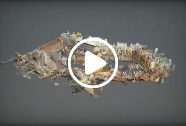
London's St Katharine Docks - Huge Point Cloud Flythrough
Our client had a lot of upcoming survey work planned for different areas of this - St Kathrine Docks in London. Using the cutting-edge NavVis VLX3 and Ivion software, we scanned the entire dock, meaning we could extract high-precision topographic data from anywhere, whenever they needed it, without any return visits. The cost and time savings for the client were substantial.
Pinpoint Pavement Condition Surveys
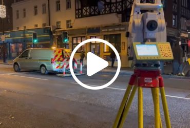
Before any road reconstruction, resurfacing, or repair project, it’s essential to understand what lies beneath the surface. Our team were recently commissioned to complete Pavement Condition Surveys along a number of major roads through London. We collected precise GPR data using a vehicle mounted array system, employing our UWB-HDAGPR Kontur Radar to accurately identify and investigate issues like pavement anomalies, shallow services and potential voiding.
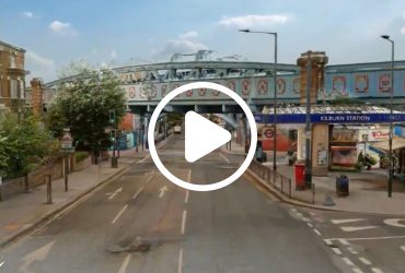
London's Kilburn High Road - 1.8km Point Cloud Flythrough
This was our longest NavVis project to date. We were tasked with surveying all 1.8km of the Kilburn High Road. First paved by the Romans, the Kilburn High Road is an ancient thoroughfare that’s been in use for centuries. Our team used the cutting-edge NavVis VLX3, which captures highly detailed reality data with unparalleled precision. Thanks to the IVION software, it’s now possible to take a stroll down this historic road whenever you like, from the comfort of your own chair!
Merging the HDAGPR survey data with 3D Laser Scanning data
Recreating the real world in a virtual environment just got a little easier. Can you imaging having this level of data at your fingertips when designing a high profile scheme? With our ground breaking (or not as the case may actually be) technology we are making the acquisition and delivery of data a safer and more reliable experience.
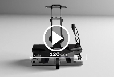
Introducing our new Stream C array system
This is the manufacturer's promotional video for the Stream C which Macleod Simmonds took delivery of in Mid November. The system has been in the field since delivery and is working perfectly. It delivers amazing results and is a worthy new addition to our fleet of GPR array systems.
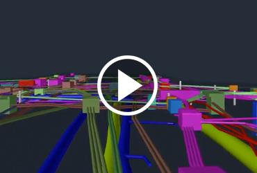
Accurately Mapped 3D Pipes
We have spent a considerable amount of time streamlining the process to virtually recreate the hidden environment accurately and time efficiently. Our software based process allows a 2D utility survey to be quickly converted into a fully interactive 3D model. You need good reliable data in the first place to facilitate the creation of an accurate 3D model, which is where our unique subsurface imaging site technologies and processes come in. How much better would your design be if it was based on information like this?