Mapping London’s Buried Cellars
13 November 2025 by: Craig Simmonds
Services aren’t the only underground obstructions that can compromise your public highway civil engineering projects. Buried cellars, often long forgotten, can cause significant project costs, timescale escalations, and affect the safety of both your workers and the public.
Nowhere is this more common than in London. The city is layered in history – understanding what lies below is crucial before breaking ground on any project. Mapping these buried cellars provides substantial benefits for urban planning, safety, heritage preservation, and infrastructure development.
Here’s a breakdown of the key advantages:
Urban Development & Construction Efficiency
- Reduces excavation risks: Knowing buried cellar locations helps avoid unexpected voids or collapses during digging, tunnelling, or piling.
- Improves planning accuracy: Developers and engineers can design foundations and basements with full awareness of subsurface constraints.
- Minimises project delays: Avoids last-minute redesigns or emergency stabilisations due to unknown underground structures.
- Enables 3D city modelling: Accurate subsurface data supports digital twins and geospatial simulations for urban resilience and climate adaptation.
Public Safety & Infrastructure Protection
- Prevents structural failures: Unmapped voids can undermine roads, buildings, or utilities. Mapping helps mitigate subsidence risks.
- Supports emergency response: Firefighters and rescue teams benefit from knowing hidden spaces that could trap smoke or people.
Heritage & Archaeological Preservation
- Protects historical assets: Many buried cellars date back centuries. Mapping enables conservation and informed decisions about reuse or protection.
- Supports archaeological research: A digital record of underground features contributes to understanding London’s layered history.
Economic & Environmental Impact
- Reduces accidental utility strikes: Cellars often intersect with old pipe routes. Mapping helps avoid damaging critical services.
- Cuts carbon and cost: Fewer surprises mean less rework, fewer vehicle movements, and lower emissions during construction.
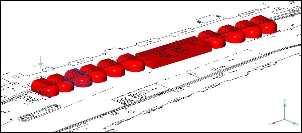
At Macleod Simmonds, using the latest High Density Array Ground Probing Radar systems (HDAGPR) and our years of expertise, we can precisely map buried cellars. We provide critical information on their extent and depth to inform your scheme designs, well ahead of breaking ground. Our advanced mapping avoids costly underground discoveries during construction, protects historical assets, and supports smarter infrastructure management.
If you’re planning public highway engineering projects and want to avoid subterranean surprises, contact the Macleod Simmonds team today.
Contact us