Old Faithful: A Decade of Delivering Results with the Stream EM
04 February 2026 by: Macleod Simmonds
Delivering industry-leading survey results isn’t just about having the latest technology, it’s about how you use it. Nothing demonstrates this better than our journey with the Stream EM. Back in the early 2000s, we were determined to find a way to improve the traditional practice of conducting GPR scans. While the existing method was compliant with the PAS128 specification, it had some significant drawbacks: conducting grid measurements required temporary paint, complicated analysis, and road closures, which were disruptive to traffic, costly, and time-consuming.
Solving this problem led to the development of a system that would serve Macleod Simmonds for over a decade, deservedly earning its nickname: Old Faithful.
Early drive for efficiency
In 2004, we began experimenting with multiple antennas towed behind a van to conduct Ground Penetrating Radar (GPR) scans. Our objectives were simple: to only scan in a single direction, without needing traffic management or paint, and to capture enough information to “image” the subsurface rather than rely on radar profile analysis. In short, we wanted to reduce man-hours while increasing the amount of carriageway data we could collect safely and efficiently.
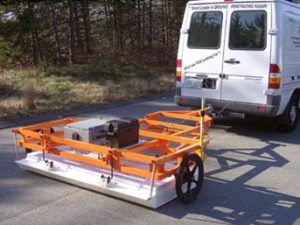
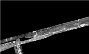
This led us to the GSSI Terravision, a 14-channel towed array radar, developed by an American GPR manufacturer. The concept was excellent. Over five nights in the City of London, we successfully captured five kilometres of kerb-to-kerb street data, which was a significant achievement at the time. However, we were severely limited by the storage space and download times, as well as the lack of processing software. Even when using custom MATLAB routines, developed with a third party, it took days to process just a few hundred metres of data.
Birth of the Stream EM
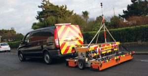
We took what we learnt from the Terravision and approached IDS Geo-Radar, an Italian GPR manufacturer. In 2008, after many meetings and a few tweaks, we took delivery of the very first IDS Stream EM Mk1: a 40-channel towed array GPR system.
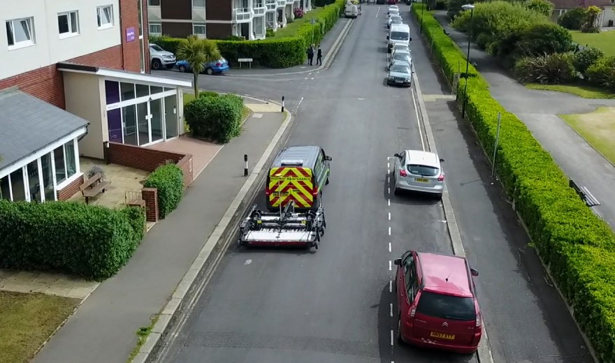
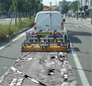
In the field, the system was exceptional. It delivered high-density data at speed and proved ideal for large open areas and carriageways. But, once again, the real challenge lay in what came next. At the time, there was no reliable software that could translate such vast and complex data into a usable CAD environment. Rather than wait for the industry to catch up, we did what we’ve always done: we built our own solution.
The solution: our expertise
Over the course of nearly three years, we worked on perfecting a bespoke software system specifically for the IDS Stream EM Mk1. Using our in-house RDxPro software as a foundation, we developed the RDxCAD, and by 2011, our in-house software had evolved into the GPRCAD.
The GPRCAD effectively provided us with a turnkey solution for covering vast areas far faster than ever before, while providing detailed imagery of the collected data. It also provided an intuitive mechanism for displaying subsurface detections in a spatially correct virtual environment, which could be layered beneath accurate above-ground topographical land survey data. This software allowed the Stream EM Mk1, Old Faithful, to be deployed quickly, safely, and consistently across major projects for many, many years to come.
The Stream EM’s remarkable service life
Over the course of its working life, Old Faithful covered thousands of kilometres of survey. It played a key role in major infrastructure projects across the UK, including extensive works at Heathrow and Gatwick airports, surveying runways, taxiways, and verges.
Across London, it supported hundreds of kilometres of carriageway surveys, contributing to the early Cycle Superhighways and numerous urban regeneration schemes. Beyond the urban environment, it was equally effective in greenfield sites, identifying archaeological features, buried structures, and utilities, as well as supporting utility route feasibility studies nationwide. By the time the Stream EM was retired in 2019, it had more than earned its nickname of Old Faithful.
More than just technology
While technology continues to evolve, the principles that delivered success with the Stream EM remain the same today: robust data collection, intelligent processing, and expert interpretation. Sometimes, the most powerful results don’t come from the newest kit on the market, but from knowing exactly how to get the best out of what you have. This combination of specialist hardware, bespoke software, and experienced interpretation is what allowed Old Faithful to truly shine at Macleod Simmonds.