Introduction
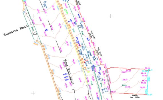
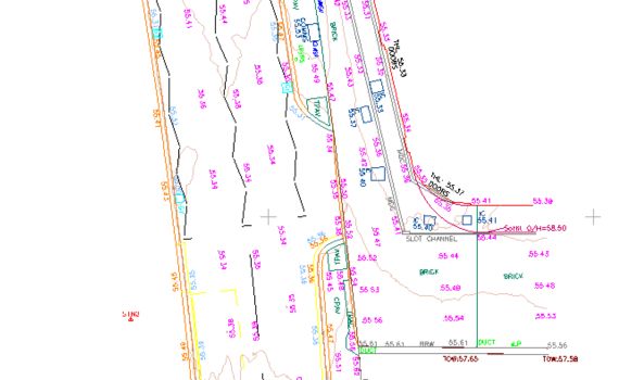
Macleod Simmonds was commissioned by Camden Council to create a PAS128 Survey of buried utilities and subsurface structures under two junction mouths identified as suitable green areas for SuDS (Sustainable Drainage System) developments. Traditionally, trial holes would be dug in multiple areas to predict the utilities and subsurface structures. Commissioned before any trial holes had been created, this project was undertaken in the early stages of planning which meant we could provide detailed insight to inform the consultation, eliminating the initial need for test holes.
The Client
Camden London Borough Council, also known as Camden Council, is the local authority for the London Borough of Camden in Greater London, England. The borough was established on 1 April 1965 from the former metropolitan boroughs of Holborn, St Pancras and Hampstead.
The Challenge
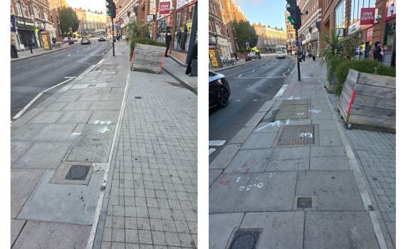
The major challenges on this project included working on live roads, whilst meeting a very tight deadline for both the survey work and data analysis. Fortunately, this turned out to be a relatively straightforward project covering two junction mouths that were light traffic areas. This meant we could conduct the surveys on live roads very early, collecting data across three days, without any impact to traffic and with zero disturbance to residents.
"As a Principal Design Engineer it is important to me to ensure that my projects are delivered on time and within budget. Having survey data this detailed ensures that the decisions I make are informed and based on reliable information."
Franco Cioffi, Principal Design Engineer (Major Projects)
The Methodology
Macleod Simmonds is exceptionally experienced in conducting surveys on live roads, adjusting the schedule of works to suit traffic flow, and selecting the right equipment to help ensure minimal disruption to the local area and residents. For this project we chose to utilise two specialist, complementary solutions that are extremely mobile and can be used quickly to scan junction mouths, building a comprehensive picture of underground assets in a highly congested urban area.
The Solutions Used
EML is a standardised method used primarily in construction, utilities and telecommunications to locate underground assets. It operates on the principle of electromagnetic induction, emitting a low-frequency signal into the ground to detect underground utilities and structures. The Stream DP radar is a revolutionary multichannel GPR array solution for real-time 3D mapping of underground utilities, providing deep underground asset detection. Used in partnership, both technologies provided a comprehensive picture of underground utilities and subsurface structures.
Implementation
Data was collected across three days, on live roads, to produce a detailed map of utilities and sub-surface structures. It took the team five days to analyse, and quality assure the findings. This was a very congested site with BT cables, electrical cabling, basement lights by the buildings, underground basements and media cables, alongside what appeared to be old tram sleepers.
"Working with the Macleod Simmonds team has consistently allowed me to deliver my schemes in the most cost-effective way possible."
Franco Cioffi, Principal Design Engineer (Major Projects)
Summary
This project is the perfect example of a Council working smarter, employing GPR solutions to create a detailed analysis of a congested area to inform a green SuDS scheme, eliminating guess work and construction delays. It’s smart both in terms of budget management and health and safety. Machine and hand digging near the identified power cables would have put the construction team in a highly volatile environment, with a high potential for serious injury. This type of best practice pre-planning positively reduces disruption to the area, the time required to design and construct the SuDS and critically, supports budget management.