Introduction
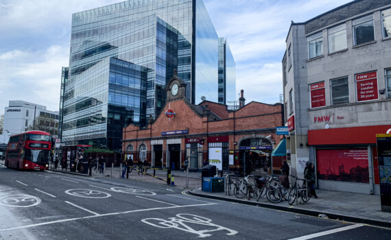
Macleod Simmonds was commissioned by FM Conway on behalf of TFL to produce a detailed map of existing utilities on the proposed route for the C9 Super Cycle Highway around the Hammersmith gyratory. This project was undertaken in the early stages of planning and construction to inform the design and route. Forming part of the Strategic Route Network (SRN), this is an area of high usage, presenting access challenges due to conflicting works on the network and access during peak times. This project therefore required careful planning and scheduling.
The Client
Transport for London (TfL) is a local government body responsible for most of the transport network in London. TfL was established in 2000 as the integrated body responsible for London's transport system. TfL's role is to implement the Mayor's transport strategy and manage transport services across the capital, for which the Mayor has responsibility. FM Conway, is one of three contractors designated as a Core Contractor for Transport for London’s (TfL) STIC framework, which includes the construction of Cycleways.
The Challenge
The SRN’s restrictions on work schedules meant that the project could not be completed in a continuous run, this led to an increase in costs and logistical challenges. Work on the C9 Super Cycle Highway was halted for a month before Christmas, due to increased traffic from Christmas shoppers, especially in the Hammersmith area, with tight restrictions placed on daytime access. Macleod Simmonds solved this issue by increasing the size of the team and carrying out detailed mapping at night when restricted access could be accommodated better.
The Methodology
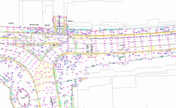
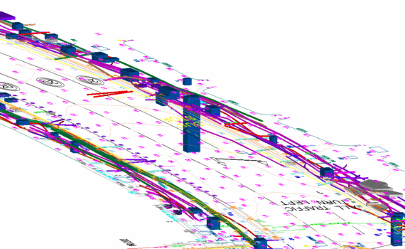
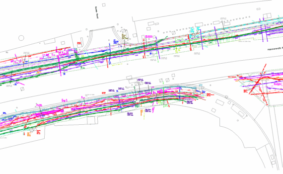
Macleod Simmonds used their new cutting-edge IDS Stream DP Array systems alongside radio locators to map this dense urban environment. The IDS Stream DP Array systems represent the pinnacle of ground-penetrating radar (GPR) technology, providing unparalleled accuracy, offering superior depth intelligence and real-time 3D mapping capabilities. These advanced systems are designed to detect and map underground utilities and features with unprecedented precision, ensuring that we can deliver the most detailed and accurate geospatial data.
Our Solution
Despite significant access and infrastructure challenges, the C9 Super Cycle Highway Project was completed successfully with the delivery of a complex utilities map to inform successful planning and construction.
“The London Strategic Road Network (SRN), TfL and the local borough have shared responsibilities for all SRN roads (which includes Hammersmith Road). TfL’s ambition is to introduce a permanent 2-way cycleway along Hammersmith Road which will change the existing layout of the road in question. The biggest challenge to this project was obtaining approval from all key stakeholders to gain access to complete the survey works. The programme of strategic traffic management, delivered by Macleod Simmonds, was critical to successfully delivering the surveys.”
Philip Yau, Project Manager, Conway
Summary
Working with accurate data, analysed by our innovative methodologies, we were able to successfully deliver a utilities map that significantly reduced the risk of hidden surprises during construction, minimising long term delays which would have a negative impact on construction budgets.