Our Services
Subsurface Imaging
Our Subsurface Imaging solutions are based primarily on High Density Array Ground Probing Radar. We operate the largest and most diverse fleet of array Ground Probing Radar (GPR) systems…
Read more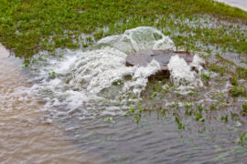
Drainage Surveys
A drainage assessment of a facility is needed where construction works are taking place or where the existing system is clearly failing. Failures can take the form of surface…
Read more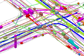
PAS128 Compliant Utility Surveys
PAS128 is a British Standards Institution (BSI) document specifying requirements for the detection, verification and location of existing and new underground utilities. Sponsored by the Institution of Civil Engineers…
Read more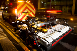
Utility Route Proving Assessments
Using the very latest Radar technology, we can offer a fast review of multiple potential routes for a planned utility installation. You can use this information to select or…
Read more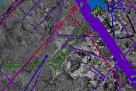
Ground Penetrating Radar Data Translation Service (GPRDTS)
With the new family of Ground Penetrating Radar Array systems becoming more and more popular, the sheer volume of data being collected can be a daunting prospect to translate…
Read more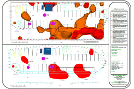
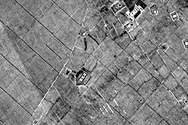
Geophysical Surveys
Geophysical Surveys use ground-based physical sensing technology to map detectable below-ground features, structures and anomalies. We use magnetometry, Electro-Resistive Tomography (ERT) and Ground Probing Radar (GPR), along with other…
Read more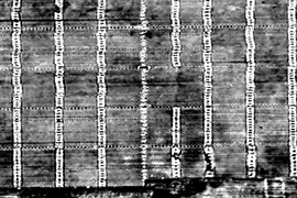
GPR Surveys and Structural Imaging
Our GPR Surveys and Structural Imaging technologies allow us to scan the inside of buildings to determine the positions of pipe and duct work within walls, under floors and…
Read more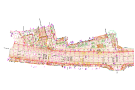
Topographical Surveys
Topographical Surveys produce accurate dimensioned maps or plan drawings of an area of interest. We use 3D scanning technology and conventional techniques to create 2D and 3D CAD maps…
Read more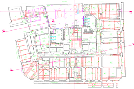
Measured Building Surveys (MBS)
Measured Building Surveys produce detailed, accurate dimensioned maps of a building or structure of interest. Using 3D scanning technology, we create BIM compliant 2D or 3D CAD views accurately…
Read more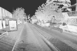
3D Laser Scanning
3D Laser Scanning is a fast, non-destructive, non-intrusive scanning technology that is rapidly becoming the industry standard for above-ground surveying. We use Light Detection and Ranging (LiDAR) to measure…
Read more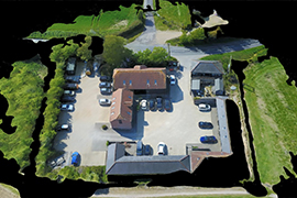
Aerial Drone Surveys (CAA Qualified)
Sometimes, you want to see what your project looks like up-close. Our Aerial Drone Surveys offer you that capability. Flying close, using High Definition (HD) video or thermal cameras,…
Read more